
Why Conservation Scientists Need to Stop Preaching to the Choir
This may sound provocative, but hear me out Earlier in the year I attended and spoke at a conservation forum. There were many excellent speakers and the topics were of conservation importance. Most of the attendees were from the conservation world, be it nature...
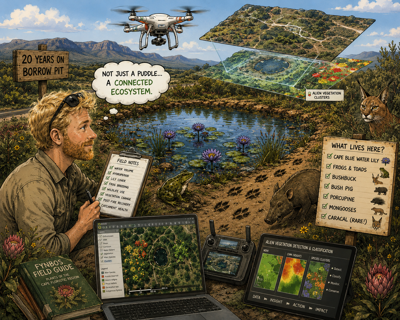
A Borrow Pit, Some Frogs and a Question I Didn’t Expect
A few weeks ago I found myself doing something that probably sounds a little odd. I was calculating the volume of water in an old borrow pit. Not exactly headline-grabbing stuff, I mean who cares, we do that on mines all the time and why monitor a road side borrow pit...
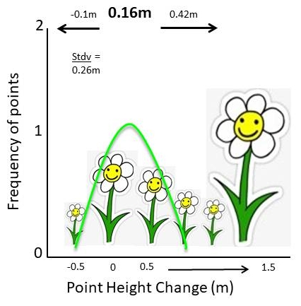
Understanding Histograms, Mean & Standard Deviation in Drone Mapping & 3D Point Cloud Analysis
Statistics are the mathematical backbone of wildlife conservation and ecology. They allow researchers to estimate population sizes, track migration patterns, understand animal behaviour, and evaluate the impacts of environmental changes or human activity on...
Why I still use the DJI Phantom 4 Pro V2 in 2026
I started out my drone journey using the DJI Spark. Bought while working on farms in Australia to film and photograph my adventures in the beautiful Aussie Outback, I never thought this compact little pocket sized bumble bee would be the start of a career shift into...
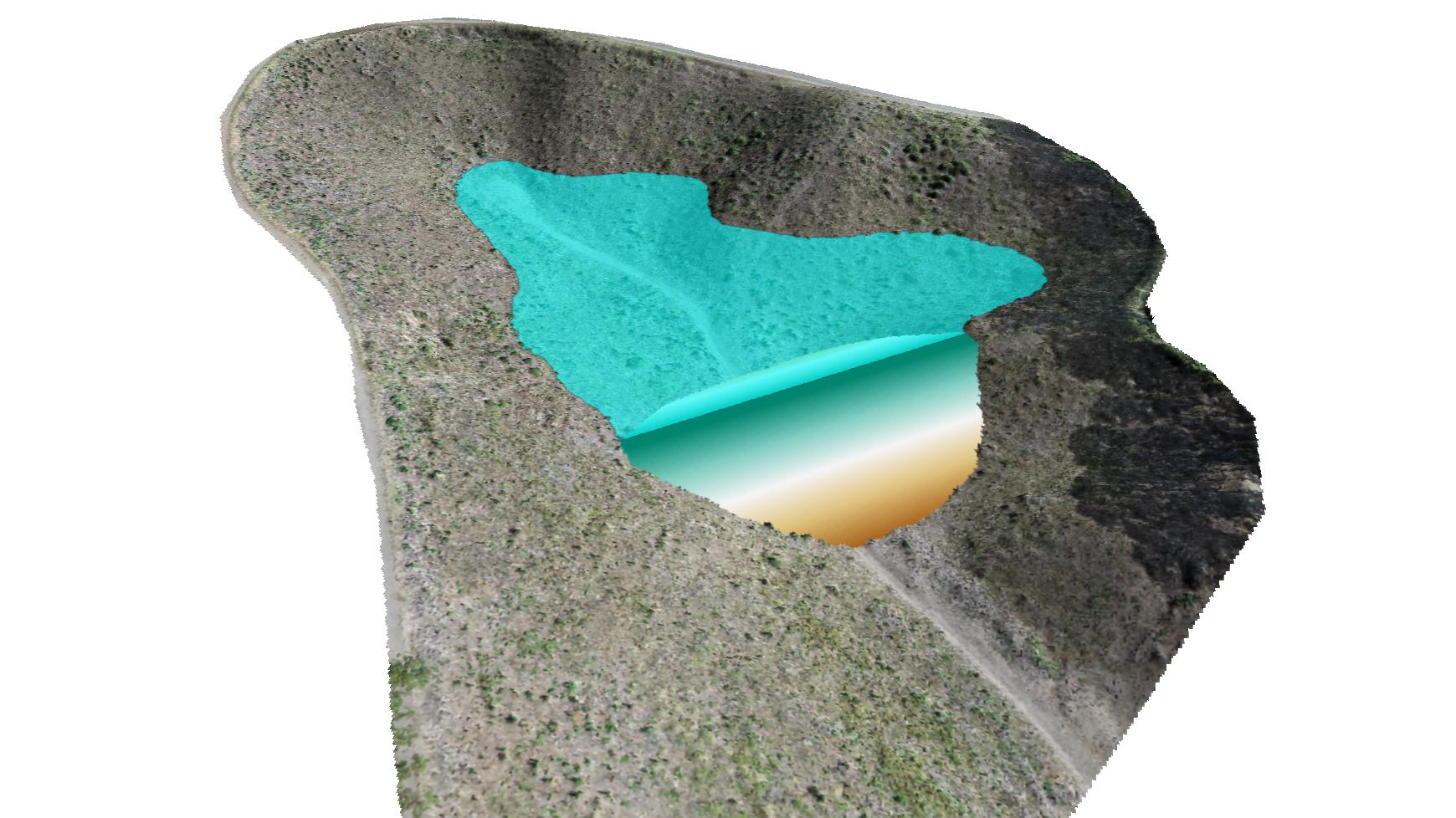
Fast Preliminary 3D Models & Reports for Dam Site Surveys
In the past I did a number of preliminary dam site survey scans for the local municipality. At the time they were looking to construct new dams for farmers that were expanding due to population increase to the region; more people= more crops = more water. I would...
Let your own creativity fly
“So here’s a thought, what is the point of learning open source? Why not just do an ESRI or ArcGIS course?” I found myself asking myself a number of years ago before I went face first, full tilt down the open source software rabbit hole. This was long before I had...
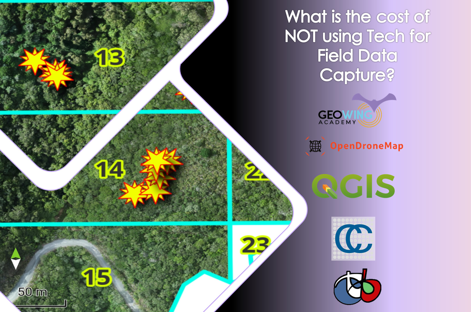
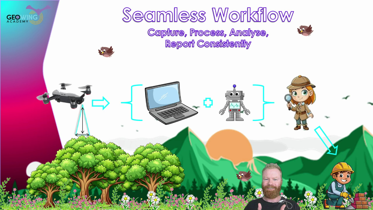
What are the costs of NOT using technology based solutions for field data capture?
Have you ever wondered how much technology actually saves a project? Well, the data is in! Here GeoWing Academy looks at a real world project that was done and compared traditional field data capture methods using pen and paper versus using a cutsomised, project...

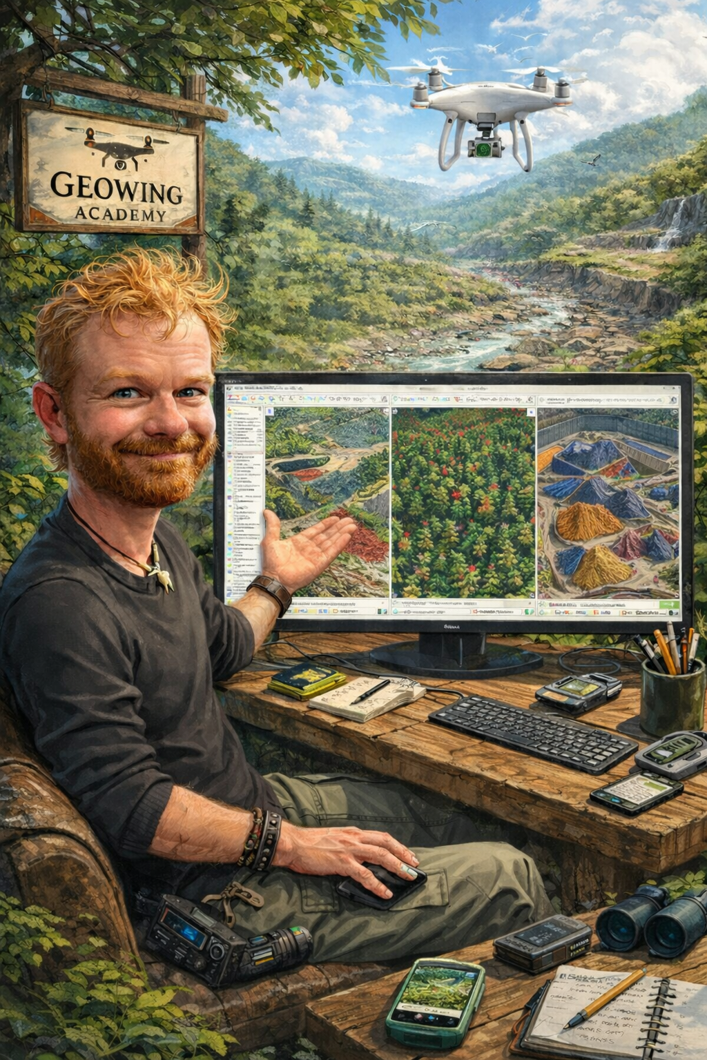
A Deep Dive Conversation About GeoWing Academy
In this deep dive conversation, we unpack what it is that GeoWing Academy is all about! What the mission is, what its all about and how easy it is for anyone and everyone to upskill themselves in all things drones and GIS.

Using Drones & GIS to Monitor the Cape Dune Mole Rat
The cape dune mole rat is an interesting creature. Mole rats usually live in social colognes but not the large Cape Dune. These fellas are viciously territorial, liver on their own and love keeping to themeselves. By looking at cape dune mole rat behaviour observed by...


Why Conservation Scientists Need to Stop Preaching to the Choir
This may sound provocative, but hear me out Earlier in the year I attended and spoke at a conservation forum. There were many excellent speakers and the topics were of conservation importance. Most of the attendees were from the conservation world, be it nature...
A Borrow Pit, Some Frogs and a Question I Didn’t Expect
A few weeks ago I found myself doing something that probably sounds a little odd. I was calculating the volume of water in an old borrow pit. Not exactly headline-grabbing stuff, I mean who cares, we do that on mines all the time and why monitor a road side borrow pit...
Understanding Histograms, Mean & Standard Deviation in Drone Mapping & 3D Point Cloud Analysis
Statistics are the mathematical backbone of wildlife conservation and ecology. They allow researchers to estimate population sizes, track migration patterns, understand animal behaviour, and evaluate the impacts of environmental changes or human activity on...
Why I still use the DJI Phantom 4 Pro V2 in 2026
I started out my drone journey using the DJI Spark. Bought while working on farms in Australia to film and photograph my adventures in the beautiful Aussie Outback, I never thought this compact little pocket sized bumble bee would be the start of a career shift into...
Fast Preliminary 3D Models & Reports for Dam Site Surveys
In the past I did a number of preliminary dam site survey scans for the local municipality. At the time they were looking to construct new dams for farmers that were expanding due to population increase to the region; more people= more crops = more water. I would...
Let your own creativity fly
“So here’s a thought, what is the point of learning open source? Why not just do an ESRI or ArcGIS course?” I found myself asking myself a number of years ago before I went face first, full tilt down the open source software rabbit hole. This was long before I had...
What are the costs of NOT using technology based solutions for field data capture?
Have you ever wondered how much technology actually saves a project? Well, the data is in! Here GeoWing Academy looks at a real world project that was done and compared traditional field data capture methods using pen and paper versus using a cutsomised, project...
A Deep Dive Conversation About GeoWing Academy
In this deep dive conversation, we unpack what it is that GeoWing Academy is all about! What the mission is, what its all about and how easy it is for anyone and everyone to upskill themselves in all things drones and GIS.
Using Drones & GIS to Monitor the Cape Dune Mole Rat
The cape dune mole rat is an interesting creature. Mole rats usually live in social colognes but not the large Cape Dune. These fellas are viciously territorial, liver on their own and love keeping to themeselves. By looking at cape dune mole rat behaviour observed by...