Dam It Course (Conservation/Agriculture)
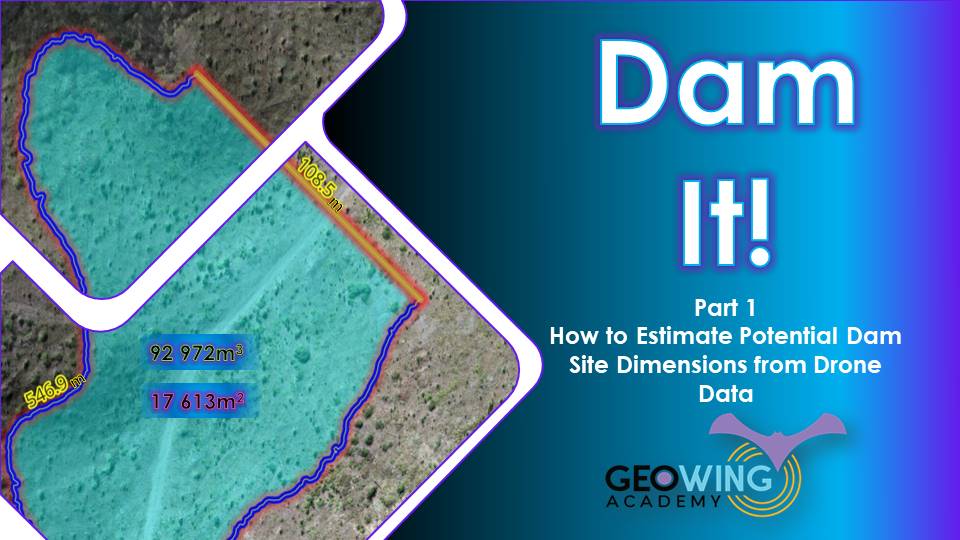
In this course you will learn how to estimate a number of quantities for a potential dam/reservoir site in 3.28.14-Firenze. This course perfect for those who would like to accurately estimate the flood plain, dam wall length, spill way height, dam wall facade area and the volume of a potential irrigation dam, water reservoir or slime dam using UAV data, photogrammetry outputs and GIS. I have left in some of the glitches so that you can see how open source is not always optimised when it is updated or alternative versions of the software are used, this will ensure that it does not come as a surprise when using updated or older/ newer versions of the software. You will need to download and install QGIS from the Software/ Hardware Requirements page for this course. In this course you will learn:
Part 1
- Introduction
- How to generate a flood plain
- How to save selected feature
- Split features
- Generate a dam wall between two points
- Snap features to features
- Merge feature layers
- Correct attribute table data
- Add measurements to dam features
- Covert line features to polygons
- Correct geometry vertices minimum
- Add attributes to newly defined dam polygon
- Rename layering to prevent confusion
- Layer symbology
- Clip layer extent for volume calculation
- Calculate reservoir volume
- Tips & Tricks
Download course training data before continuing