How drones, AI & Open Source Software can be used to combat Alien Invasive Plants in South Africa
Alien Invasive Plants (AIP) have become a major threat to South Africa's sensitive Fynbos biome. In 2017 and 2018, fires in the Western Cape region killed 8 people and destroyed over 2000 homes and devastated biodiversity in the region. The intensity of these fires...

Can RGB Drones & Machine Learning Be Used for Crop Health Analysis?
ere Machine Learning and RGB drone data for plant health? GeoWing Academy decided to take a look at how effective using a custom built machine learning pipeline and RGB derived plant health indices for crop health analysis. The results are SUPER interesting! A...
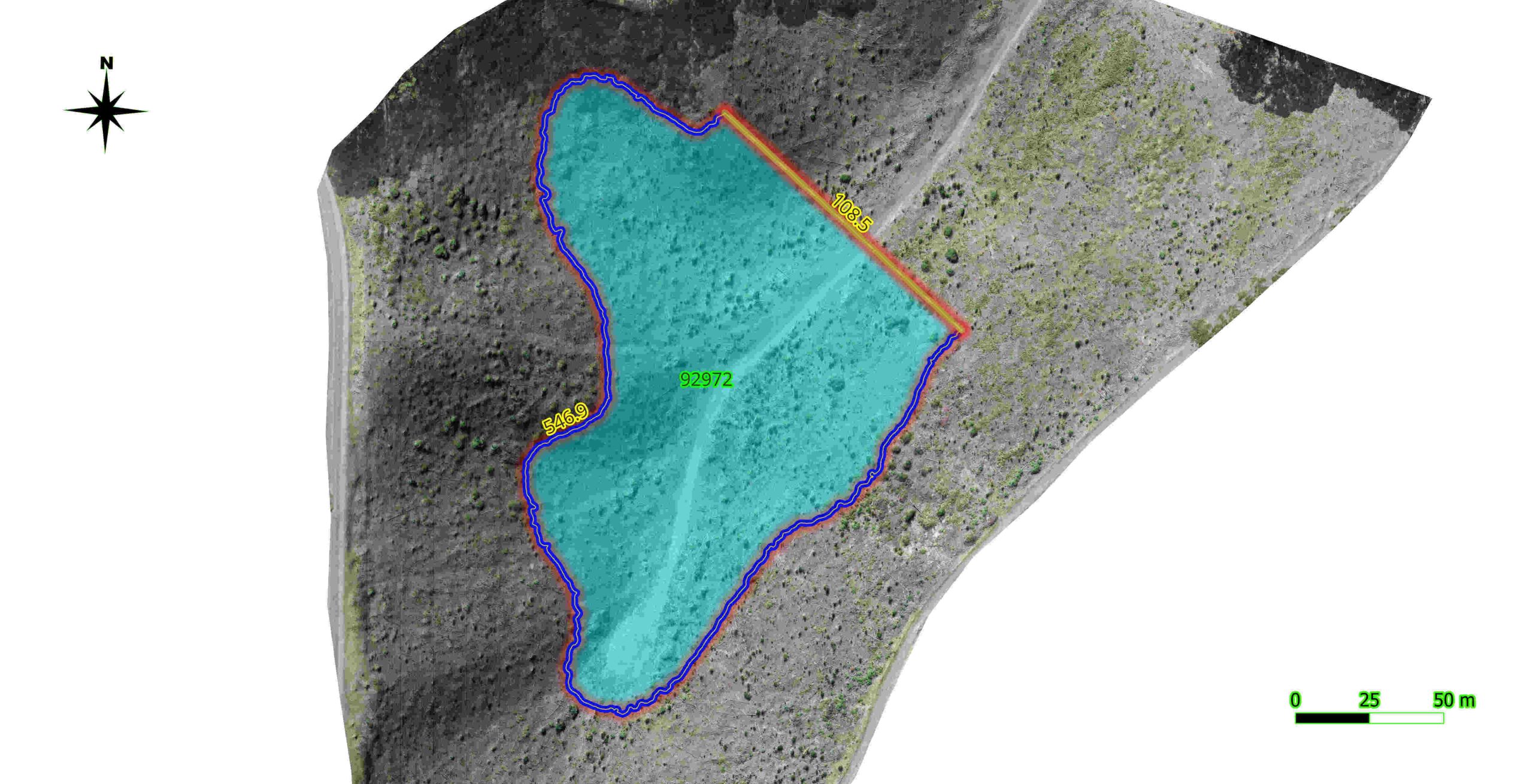
Dam It! How drones can be used to survey potential dam and reservoir sites
15 years ago I was managing a game reserve in the Mapungubwe area in North Limpopo South Africa. The reserve had not had a permanent manager and there was some serious need for maintenance on fences, roads and dams. In fact there was only one of the four dams on the...

What does it cost to introduce Machine-Learning into conservation, forestry & agriculture management?
When looking at orchards and plantations, the short answer to this question is “Much less than you think”! The long answer: “How to go about it?” Let’s dissect that a little shall we? Data collection using an off-the-shelf consumer drone that is capable of functioning...
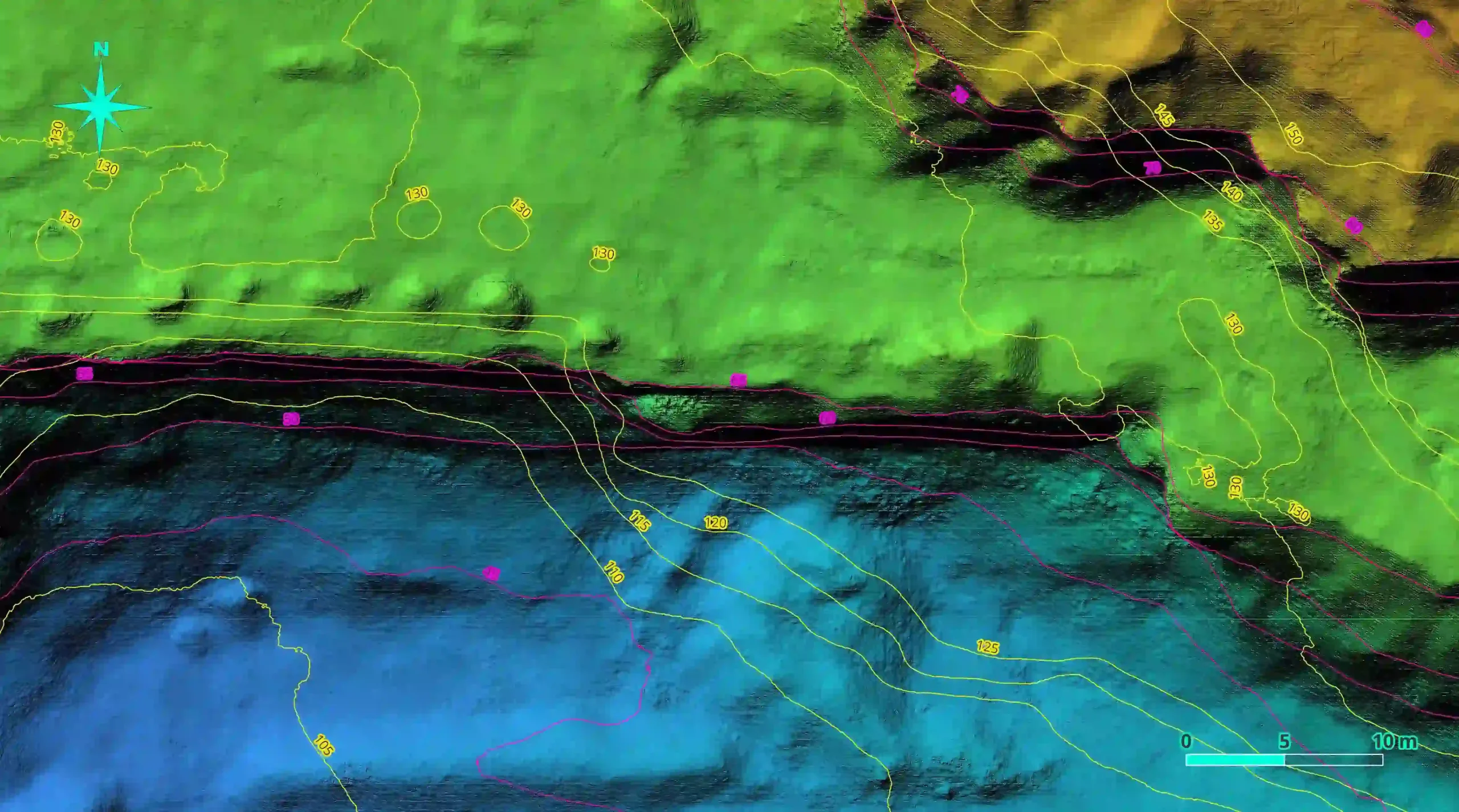
Did you know about elevation and GPS offsets between drone data collected on different dates and how it effects photogrammetry processing?
When it comes to capturing drone data correctly, it is important to understand what will happen during photogrammetry processing and how this will affect the results. It is also important to understand how the meta data used in the photogrammetry process changes from...
Can drones be the answer to urbanisation and conservation conflicts?
I live in a small town on the coast in a part of the world where beauty knows no bounds. As I write this the sound of birdsong outside my window echoes through the valley below and the chirps of frogs rise up from the tributary that winds its way beneath the forest...
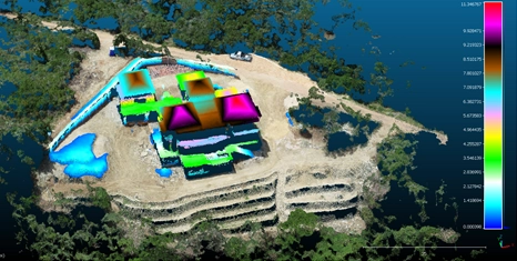
Exploring the Power of Consumer Drones and Open Source Software in Various Fields
In recent years, the combination of off-the-shelf consumer drones, open-source photogrammetry, and GIS (Geographic Information System) software has revolutionized several industries. These technologies offer affordable, efficient, and highly accurate methods for data...
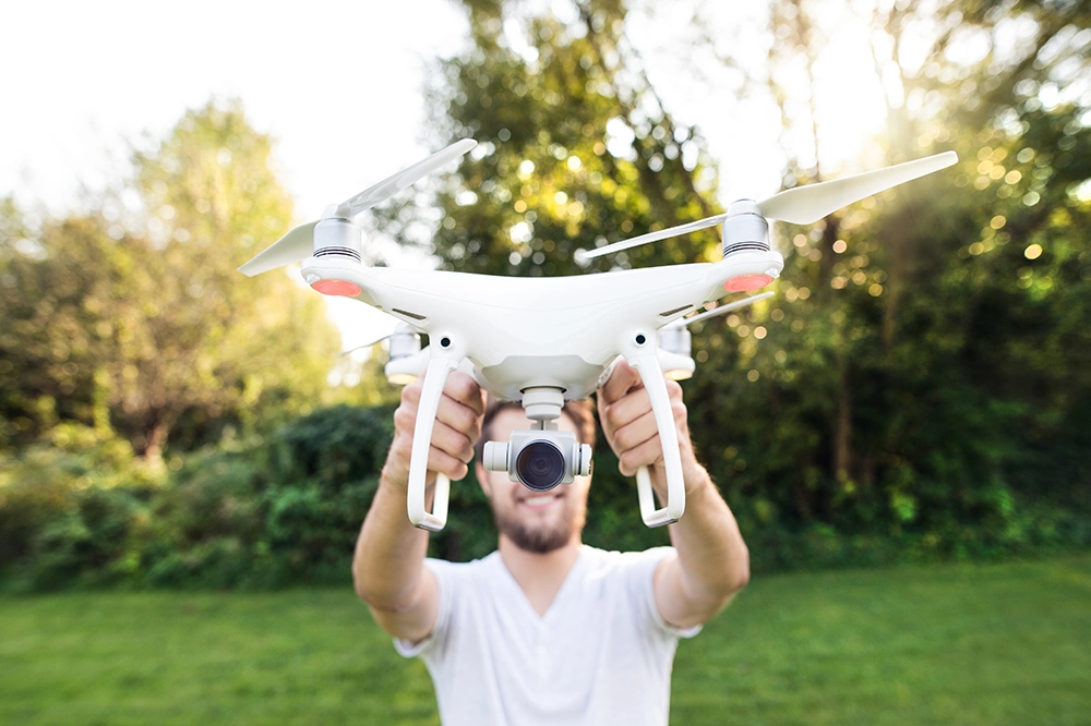
How it began
While living in Australia in 2017 I purchased my first drone, a DJI Spark to be precise. My intentions were to document my travels around the beautiful country and compile short videos of my adventures. I was astonished at how many features were packed into such a...


How drones, AI & Open Source Software can be used to combat Alien Invasive Plants in South Africa
Alien Invasive Plants (AIP) have become a major threat to South Africa's sensitive Fynbos biome. In 2017 and 2018, fires in the Western Cape region killed 8 people and destroyed over 2000 homes and devastated biodiversity in the region. The intensity of these fires...
Can RGB Drones & Machine Learning Be Used for Crop Health Analysis?
ere Machine Learning and RGB drone data for plant health? GeoWing Academy decided to take a look at how effective using a custom built machine learning pipeline and RGB derived plant health indices for crop health analysis. The results are SUPER interesting! A...
Dam It! How drones can be used to survey potential dam and reservoir sites
15 years ago I was managing a game reserve in the Mapungubwe area in North Limpopo South Africa. The reserve had not had a permanent manager and there was some serious need for maintenance on fences, roads and dams. In fact there was only one of the four dams on the...
What does it cost to introduce Machine-Learning into conservation, forestry & agriculture management?
When looking at orchards and plantations, the short answer to this question is “Much less than you think”! The long answer: “How to go about it?” Let’s dissect that a little shall we? Data collection using an off-the-shelf consumer drone that is capable of functioning...
Did you know about elevation and GPS offsets between drone data collected on different dates and how it effects photogrammetry processing?
When it comes to capturing drone data correctly, it is important to understand what will happen during photogrammetry processing and how this will affect the results. It is also important to understand how the meta data used in the photogrammetry process changes from...
Can drones be the answer to urbanisation and conservation conflicts?
I live in a small town on the coast in a part of the world where beauty knows no bounds. As I write this the sound of birdsong outside my window echoes through the valley below and the chirps of frogs rise up from the tributary that winds its way beneath the forest...
Exploring the Power of Consumer Drones and Open Source Software in Various Fields
In recent years, the combination of off-the-shelf consumer drones, open-source photogrammetry, and GIS (Geographic Information System) software has revolutionized several industries. These technologies offer affordable, efficient, and highly accurate methods for data...
How it began
While living in Australia in 2017 I purchased my first drone, a DJI Spark to be precise. My intentions were to document my travels around the beautiful country and compile short videos of my adventures. I was astonished at how many features were packed into such a...